"Reproduced by permission of Geographers' A-Z Map Co Ltd & with kind permission of Ordnance Survey"


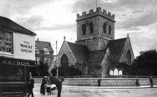
St. James Church Gravesend
|
The Wheatsheaf public house on the corner of Darnley Road is shown in it's original clapboard state. St. James's Church was built in 1852 and demolished in 1968. The first encumbent, Reverend John Joynes, is remembered today by the name of the K.C.C. offices that were built on the site, 'Joynes House'. There are only a few of the original houses left in New Road and around the corner in Darnley Road, mainly visible by their roof structures and timber clapboarding at the rear of the properties.
|

|
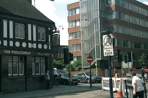
The Wheatsheaf on the left has changed to a degree, as have the windows on the ground
and first floor.
Also the walls are covered in green ceramic tiles which give it quite a nice finish.
The building on the other side of the junction is the offices of the local Social Services.
|